
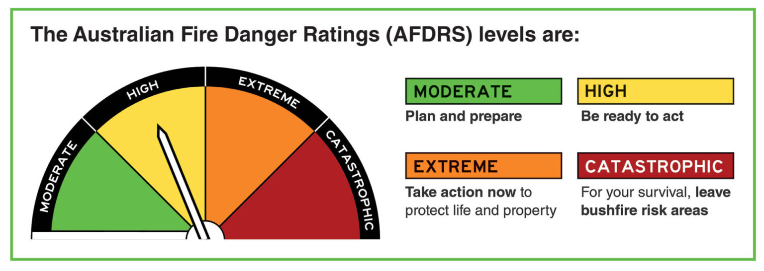
Fire Danger Ratings
Fire Danger Rating Signs display the level of risk posed by a bushfire on any given day, as issued by the Bureau of Meteorology. By relating the factors of the degree of curing of the fuel (i.e. how dry it is), the wind speed and atmospheric moisture (Relative Humidity), a fire danger index figure is produced. It is then expressed as a danger classification ranging from Moderate to Catastrophic. This rating system, as illustrated below, ensures a realistic forecast as it takes into account all elements that contribute to the probability of a fire and it’s severity.
Information on the current fire danger rating can be obtained from the Bureau of Meteorology or alternatively by checking our Fire Danger Rating Signs at the following locations:
Wanneroo
-
- Neaves Rd, Mariginup
- Old Yanchep Rd, Pinjar
- Gnangara Rd, Landsdale
- Cnr Joondalup Drive and Wanneroo Rd
Quinns Rocks
-
- Wanneroo Rd, South of Yanchep Beach Rd Turn-off
- Wanneroo Rd, Carabooda
- Marmion Ave, Jindalee
Two Rocks
-
- Country Side Drive, Two Rocks
Fire Restrictions
Important Dates for Burning
Different fire restrictions apply in the City of Wanneroo throughout the year. The information below is contains standardised dates, are intended as a guide only and should be confirmed with the City of Wanneroo on (08) 9405 5000 before being acted on.
-
- PROHIBITED BURNING PERIOD – 1 DECEMBER to 31 MARCH INCLUSIVE (No burning. Permits will not be issued).
- RESTRICTED BURNING – 1 APRIL to 31 MAY ANNUALLY (Permit required).
- UNRESTRICTED BURNING – 1 JUNE to 31 AUGUST ANNUALLY (No permit required).
- RESTRICTED BURNING – 1 SEPTEMBER to 30 NOVEMBER ANNUALLY (Permit required).